The best Quebec fall colors map is the free interactive map from Bonjour Québec: it tracks the fall colours in more than 60 parks and regions, from “beginning soon” to “peak” and “end”, and is updated every week during the season. The leaves usually peak between mid-September and mid-October. Below, I show you how to use the map, then share my 10 best spots to see the fall colors in Quebec, from Montreal to the Quebec City region.
Quebec Fall Colors Map 2026: Track the Leaves in Real Time
Many places offer breathtaking views, but you still need to be there at the right time. So how do you know whether to choose Mont-Tremblant, La Mauricie, or head to Mont Orford in the Eastern Townships instead?
The answer is the 2026 fall colours map from Bonjour Québec, the official Quebec tourism site. It covers more than 60 national parks, regional parks and outdoor sites, sorted by region. Each spot gets a color stage (beginning soon, début, mid-point, near peak, final glimmers, end), and the map is updated weekly throughout the season.
My tip to use the map
Check the map on the Wednesday or Thursday before your weekend outing, then pick a spot marked “mid-point” or “near peak”. In practice, that is when the colors are the most intense, and you still have a few days of margin before the leaves fall.


So don’t wait any longer: plan your fall outing today and discover Quebec at its most beautiful.
When is the best time to see the fall colors in Quebec?
The color season usually starts in the first week of September in the northern and higher-altitude regions, then gradually moves south across the province. The peak most often falls between September 20 and October 10, depending on the region: it arrives around the end of September in the Laurentians and Mauricie, and a little later in the Eastern Townships. Before you leave, check the interactive map above to adjust your itinerary to how the season is actually progressing.
My top 10 most beautiful places to see the fall colors in Quebec
From the trails closest to Montreal to the spectacular valleys of the Quebec City region, here are my favorites for this fall.
1. Mont-Tremblant National Park (Laurentians)
About 2 h 15 from Montreal, this park offers one of the most beautiful color displays in the province, with lakes surrounded by mountains and plenty of lookouts to take in the view. You can admire the scenery by kayak or paddleboard on Lac Monroe, or go hiking on one of the park’s many trails. For a bird’s-eye view, take the gondola at the Tremblant resort, right next to the park. If you get the chance to camp there, enjoy sunrise and sunset over the treetops: it’s a wonderful experience.
Good to know: Mont-Tremblant National Park is one of the most popular spots this time of year. Book your accommodation in advance. Also keep in mind that Tremblant village gets very busy, as do the park’s most accessible hikes.

2. La Mauricie National Park (Mauricie)
This vast and incredible park offers more than 100 km of trails and striking views over the Saint-Maurice River. About 2 hours from Montreal, it’s well worth the trip. In the fall, I especially recommend the Mékinac trail for its views over the valley. It starts from the Rivière-à-la-Pêche service centre (Saint-Jean-des-Piles entrance).
- Total distance: 5.5 km loop
- Duration: 3 h
- Level: intermediate to difficult

3. Jacques-Cartier National Park (Quebec City region)
40 km north of Quebec City, this spectacular glacial valley bursts with vivid colors that contrast with its rock walls. The Les Loups trail takes some stamina, but it offers one of the best views of the Jacques-Cartier River.
- Total distance: 11 km (450 m elevation gain)
- Level: intermediate to difficult
More accessible, although rated intermediate, L’Éperon trail lets you see both the Jacques-Cartier River and the Rivière à l’Épaule. Your efforts will be rewarded with the magnificent scenery nature offers in the fall.
- Total distance: 5.4 km (210 m elevation gain)
- Level: intermediate
4. Montagne Noire (Saint-Donat, Lanaudière)
Famous for the observation tower at its summit, the Montagne Noire trail in Saint-Donat leads to one of the highest peaks in the Laurentians. It’s a must in September and October for a 360° view of the colorful forest. Pick a dry day for this difficult hike to avoid ending up in the mud. The loop offers varied perspectives over the forest, and the view is worth the effort. Stop for lunch at the Le Mésangeai shelter or right at the observation tower.
- Total distance: 6.6 km (223 m elevation gain)
- Estimated duration: 2 to 3 h
- Level: difficult
5. Sept-Chutes Regional Park: the Mont Brassard Loop (Lanaudière)
Less famous than its neighbors in Saint-Donat, Sept-Chutes Regional Park, in Saint-Zénon, is one of my favorite fall discoveries in Lanaudière. About 2 hours from Montreal, it offers one of the most impressive views in the region.
The Mont Brassard Loop starts at the park’s welcome center and first follows the Noire River, near the Voile de la Mariée waterfall. Then the climb gets steady all the way to the large rock slabs at the summit.
From the top, the lookout gives you a sweeping view of Lac Rémi, the Noire River valley and the hills around Saint-Zénon. At peak color, the contrast between the deep blue water and the red and gold forest is simply spectacular.
My tip
Park access is paid: if the welcome center is closed, you can pay for parking online or at the parking meter. Wear good hiking shoes, since the trail has several rocky sections. Good news: dogs are allowed.
- Total distance: 5.7 km loop (410 m elevation gain)
- Estimated time: 3 to 4 hours
- Level: intermediate
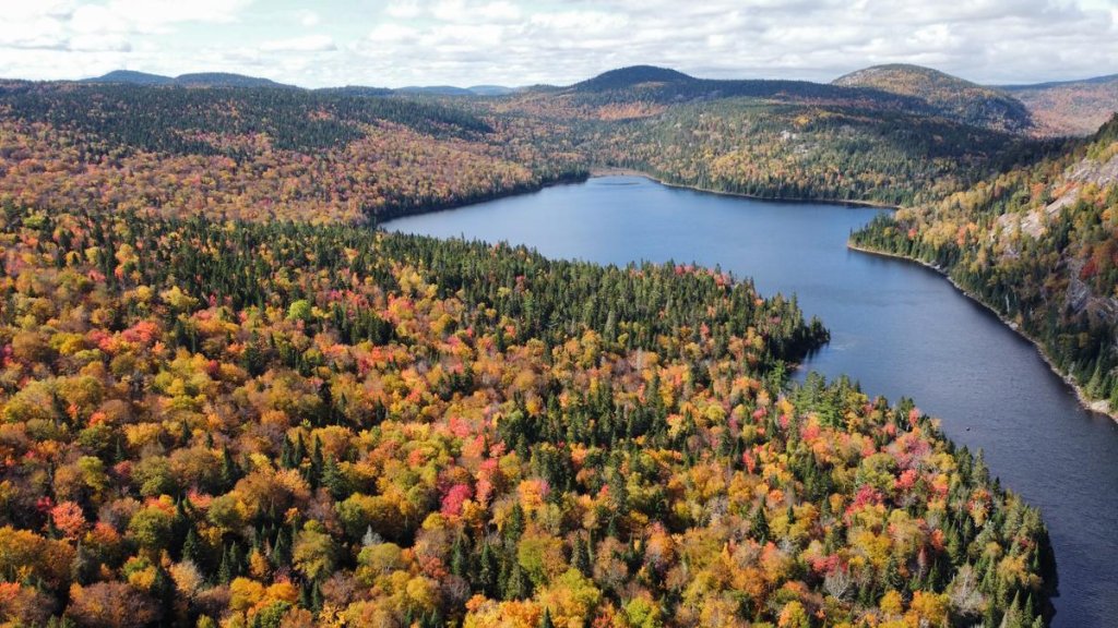
6. Forêt Ouareau Regional Park (Lanaudière)
About 1 h 30 from Montreal, this forest offers many trails with magnificent viewpoints. Its family-friendly, safe trails wind through a forest that turns bright with color. Here are a few trails to discover, by difficulty:
- Petite rivière du Nord, for a short, easy walk: 2.1 km (Grande-Jetée sector), easy
- Belvédère de la Croix loop, for great views: 2.5 km from the Massif sector or 5.8 km via the Contreforts trail, intermediate
- Ancien poste loop, for a long, sporty day: 16.8 km from the Massif sector, difficult
7. Mont Sourire (Saint-Donat, Lanaudière)
If there’s one trail with an incredible view for very little effort, it’s Mont Sourire. In under 2 km, you easily reach the lookout, with views of Saint-Donat village, Montagne Noire, Mont Ouareau and Mont Kaaikop. If you still have energy, you can extend the loop to Mont Carcan and Mont d’Or.
- Total distance: 2 km (80 to 120 m elevation gain)
- Estimated duration: 1 h
- Level: easy
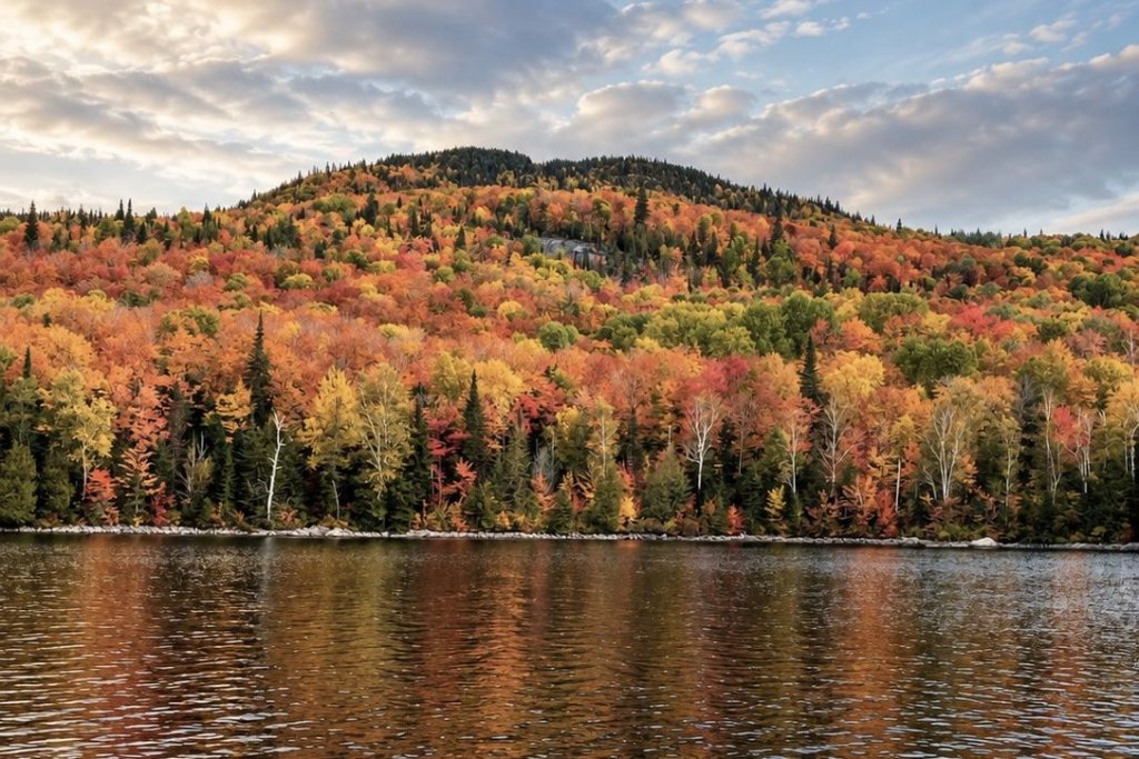
8. Mont Orford (Eastern Townships)
About 1 h 30 from Montreal, the Orford area is known for the intensity of its colors. National park trails, ski resort slopes or the local color festival: there’s no shortage of options. I recommend the Pékan trail, which leads to the top of Colline des Pins and offers a lovely view of Mont Orford and the Étang aux Cerises valley. Perfect for an easy, peaceful outing.
- Distance: 5.5 km (loop or out-and-back depending on the sector)
- Level: easy
9. Gatineau Park (Outaouais)
Right next to Ottawa-Gatineau, this park offers free access to spectacular forest trails. The Luskville Falls trail climbs 300 metres, with a steep, rocky ascent at the start, for a red-and-gold panorama over the whole valley.
Good to know: the park is managed by the National Capital Commission (NCC). Check parking conditions on its website before you go.
- Distance: 4.2 km (loop)
- Duration: 2 h 30
- Level: difficult
10. Mont Sutton (Eastern Townships)
The charm of Sutton village comes together with the trails of the Parc d’environnement naturel de Sutton (PENS) and the activities at the ski resort. For thrill-seekers, the giant zipline offers a breathtaking view of the surrounding colors. I recommend the Round Top trail: it’s the best-known trail in the area and leads to the highest peak of the massif, at 968 metres. The climb passes peaceful Lac Vogel and Lac Spruce, then ends with a steeper ascent with wooden stairs and rocks.
- Distance: about 7.4 to 8.7 km (loop)
- Estimated duration: 2 h 30 to 3 h 30
- Level: intermediate to challenging
Frequently asked questions
When do the fall colors start in Quebec?
The first colors usually appear in late August or early September in the northern and higher-altitude regions. The peak most often falls between September 20 and October 10, depending on the region and that year’s weather.
Where can I see the fall colors near Montreal?
Mont-Tremblant National Park, Forêt Ouareau, Saint-Donat (Montagne Noire and Mont Sourire), Sept-Chutes Regional Park, Mont Orford and Sutton are all 1 h 30 to 2 h 30 from Montreal by car, and all offer spectacular fall views.
Where can I see the fall colors near Quebec City?
Jacques-Cartier National Park is about 40 km north of Quebec City.
How can I follow the fall colors in real time?
Bonjour Québec’s interactive map, updated regularly in September and October, lets you track how the colors are progressing region by region before planning your outing. You’ll find it in the “Follow the fall colors in real time” section of this article.
Do I need to book to visit Quebec's national parks in the fall?
Yes: weekends during color season are very popular. In SÉPAQ national parks (Mont-Tremblant, Jacques-Cartier, Mont-Orford), it’s recommended to book your access and parking several days, or even weeks, in advance. La Mauricie National Park is managed by Parks Canada and Gatineau Park by the National Capital Commission (NCC): check their respective access conditions before you go.
In summary
In short, from the Laurentians to the Quebec City region, via Lanaudière and the Eastern Townships, Quebec offers an incredible variety of landscapes to admire the fall colors. Whether you’re looking for a day trip from Montreal or a multi-day road trip to the Quebec City region, there’s surely a spot on this list waiting for you this fall.